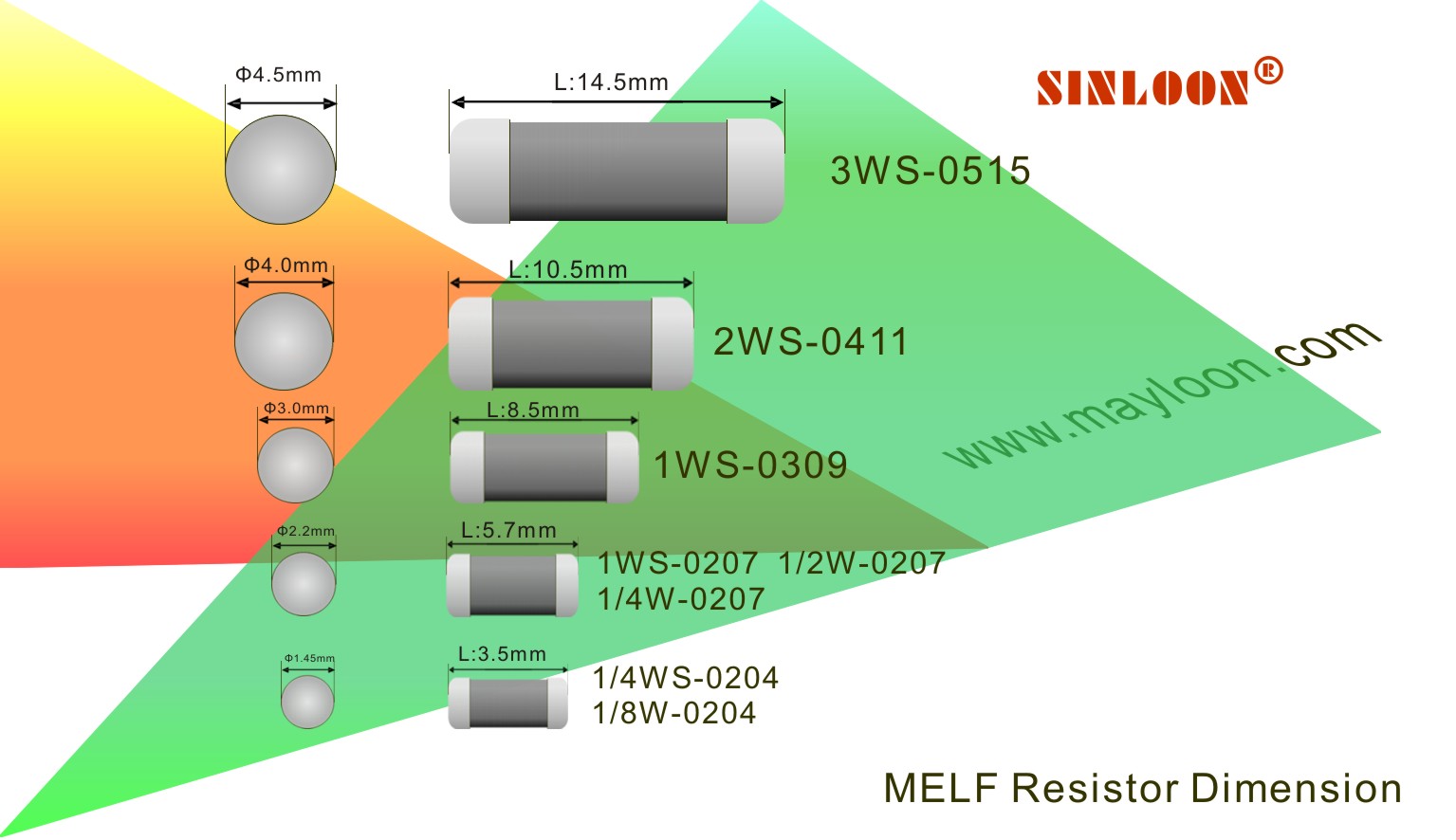
| SINLOON® | 高精密金屬膜晶圓電阻 | Q-MPM11 (2WS) | ||||||
| Tolerance: ±0.1% ~ ±1% | Precision Metal Film MELF Resistor | |||||||
 EATURES EATURES |
 |
 |
 |
|||||
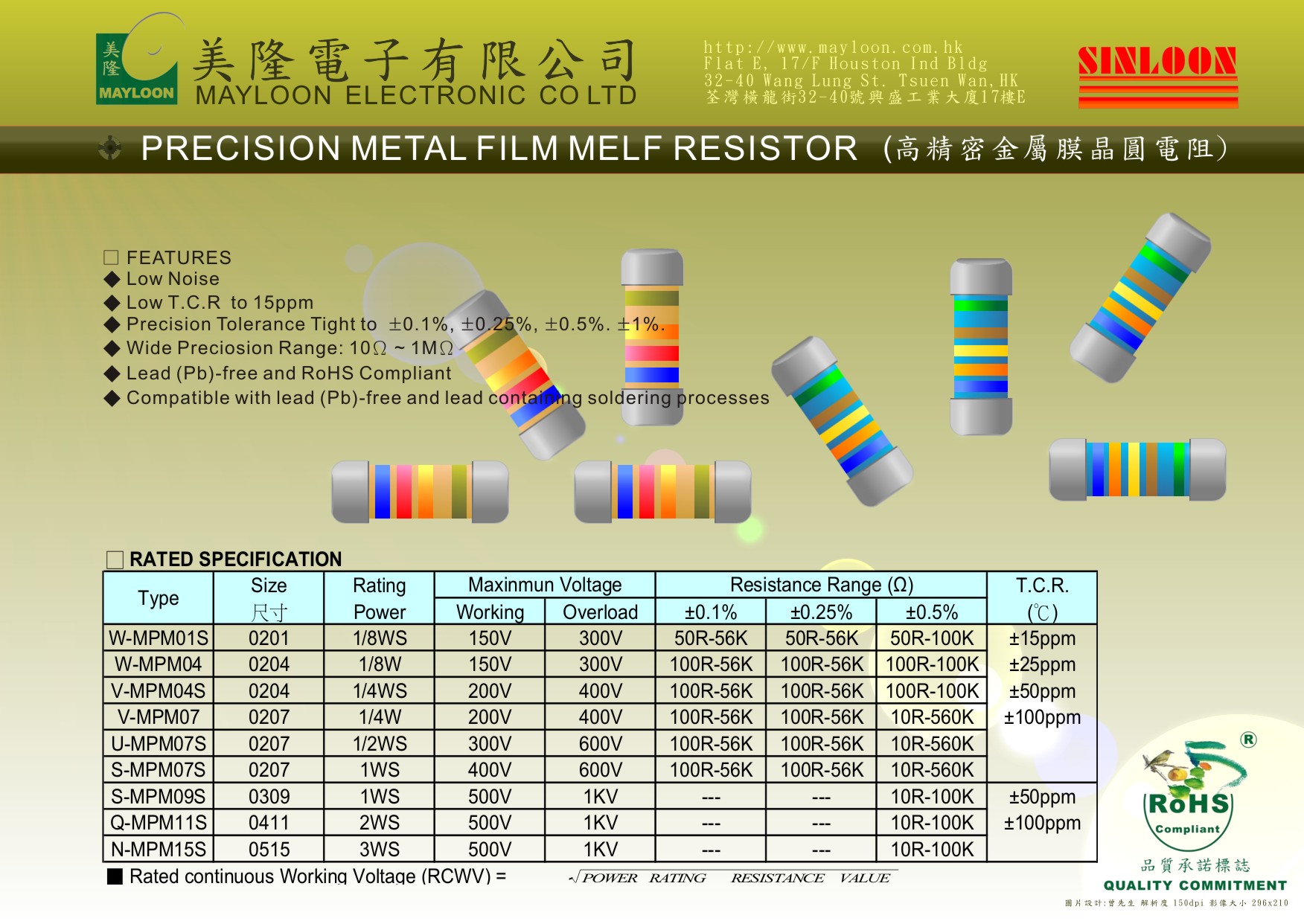
| Low Noise | ||||||||
| Low T.C.R to 15ppm | ||||||||
| Precision Tolerance Tight to ±0.1%, ±0.25%, ±0.5%. ±1%. | ||||||||
| Wide Precision Range: 10Ω ~ 1MΩ | - | - | ||||||
| Lead (Pb)-free and RoHS Compliant | ||||||||
| Compatible with lead (Pb)-free and lead containing soldering processes | ||||||||
 PPLICATIONS PPLICATIONS |
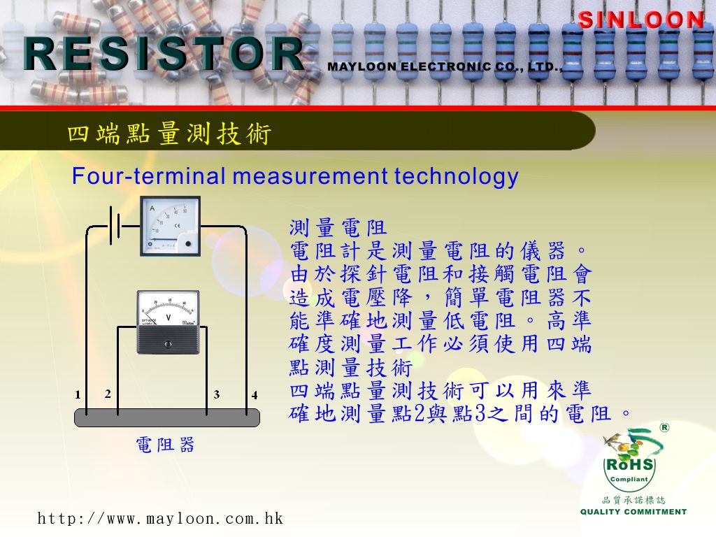
四端點量測技術可以用來準確地測量點2與點3之間的電阻。 | |||||||
| Test and measuring equipment | 測量電阻 電阻計是測量電阻的儀器。由於探針電阻和接觸電阻會造成電壓降,簡單電阻器不能準確地測量低電阻。高準確度測量工作必須使用四端點測量技術(four-terminal measurement technology)。 |
|||||||
| Industrial and medical electronics | ||||||||
| The MPM- Metal film Resistor are made by depositing special treated | ||||||||
| metal film onto ceramic core in ultra high vacuum. Both ends | ||||||||
| of the core are plated with precious metal to ensure low noise | ||||||||
| and small temperature coefficient. MPM Resistor are widely applied in | ||||||||
| high fidelity stereo, electronic calculators, computers, testing instruments, | ||||||||
| meters, auto controlled equipment, military devices and aerospace equipment. | ||||||||
| RATED SPECIFICATION | ||||||||
| Type | Size | Rating | Maximum Voltage | Resistance Range (Ω) | Package | |||
| Power | Working | Overload | ±0.1% | ±0.25% | ±0.5% | Quantity Reel | ||
| Q-MPM11 | 0411 | 2WS | 500V | 1000V | ---- | ---- | 10R-100K | 2000 pcs |
 |
||||||||
| < 前一個 | 下一個 > |
|---|